4,9 km | 0 m-effort
Glenveagh Castle
Bernard Lejeune
Benutzer
Länge
32 km
Maximale Höhe
243 m
Positive Höhendifferenz
519 m
Km-Effort
39 km
Min. Höhe
39 m
Negative Höhendifferenz
519 m
Boucle
Ja
Erstellungsdatum :
2022-06-10 17:35:01.596
Letzte Änderung :
2022-06-10 17:35:43.948
2h43
Schwierigkeit : Schwierig
Kostenlosegpshiking-Anwendung
Über SityTrail
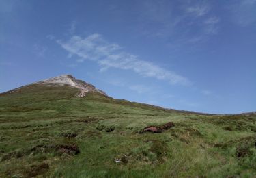
Tour Mountainbike von 32 km verfügbar auf Unbekannt, County Donegal, Glenties Municipal District. Diese Tour wird von Bernard Lejeune vorgeschlagen.
Ort
Land:
Ireland
Region :
Unbekannt
Abteilung/Provinz :
County Donegal
Kommune :
Glenties Municipal District
Standort:
Cross Roads ED
Gehen Sie:(Dec)
Gehen Sie:(UTM)
567850 ; 6101670 (29U) N.
Kommentare
Touren in der Umgebung
Irlande 45 Errigal Mountain
Wandern
Medium
Glenties Municipal District,
Unbekannt,
County Donegal,
Ireland
2h 36min
Ja
Letterkenny boucle WAW Part 13
Auto
Sehr leicht
Letterkenny Municipal District,
Unbekannt,
County Donegal,
Ireland
225 km | 262 km-effort
Unbekannt
Ja
Lough Salt
Wandern
Sehr leicht
Letterkenny Municipal District,
Unbekannt,
County Donegal,
Ireland
7,1 km | 10,4 km-effort
3h 0min
Ja
JN°9 - 10 LETTERKENNY LUSK (NORD DUBLIN)
Motorrad
Sehr leicht
Letterkenny Municipal District,
Unbekannt,
County Donegal,
Ireland
384 km | 434 km-effort
5h 0min
Nein
JN°9 - 10 DIMANCHE LUNDI LETTERKENNY LUSK (NORD DUBLIN) 2 NUITS
Motorrad
Sehr leicht
Letterkenny Municipal District,
Unbekannt,
County Donegal,
Ireland
297 km | 333 km-effort
4h 0min
Nein
J N°8 SAMEDI NORD EST LETTERKENNY 2 NUITS
Motorrad
Sehr leicht
Letterkenny Municipal District,
Unbekannt,
County Donegal,
Ireland
234 km | 273 km-effort
4h 0min
Ja
gortahork
Wandern
Schwierig
Glenties Municipal District,
Unbekannt,
County Donegal,
Ireland
10,1 km | 12,9 km-effort
3h 9min
Ja